Trail Walking Chamalières-sur-Loire - Suc de Bartou - Photo
 Iahns
Iahns

User

© OpenStreetMap contributors
Length
Length
3.9 km
Max alt
Max alt
974 m
Uphill gradient
Uphill gradient
173 m
Km-Effort
Km-Effort  
6.2 km
Min alt
Min alt
810 m
Downhill gradient
Downhill gradient
173 m
Boucle
Boucle
Yes
Creation date :
2020-07-14 12:39:57.689
Updated on :
2020-07-14 14:05:12.025

(0 Reviews)

Walking
Walking
1h24
Difficulty : Medium

Scan this QR Code to open this trail in the SityTrail application

FREE GPS app for hiking

Logo SityTrail SityTrail

IGN / Geographical institutes

Download SityTrail from the App Store Download SityTrail from Google Play

Logo SityTrail SityTrail World

The world is yours!

Download SityTrail from the App Store Download SityTrail from Google Play Download SityTrail on Huawei AppGallery

About

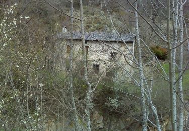
Trail Walking of 3.9 km to be discovered at Auvergne-Rhône-Alpes, Haute-Loire, Chamalières-sur-Loire. This trail is proposed by Iahns.

Description

Depuis Varennes via Costaros

Elevation profile

Positioning

Country:
France
Region :
Auvergne-Rhône-Alpes
Department/Province :
Haute-Loire
Municipality :
Chamalières-sur-Loire
Location:
Unknown
Start:(UTM)
575963 ; 5002567 (31T) N.

Trails nearby

Trail Walking Chamalières-sur-Loire - Suc de Bartou - Rocher de Costaros - Photo
Walking
Jackoyo

Walking

Medium
Chamalières-sur-Loire, Auvergne-Rhône-Alpes, Haute-Loire, France
4.5 km | 7 km-effort
1h 20min
Yes
Trail Walking Chamalières-sur-Loire - Le rocher de Costaros - Photo
Walking
Jean-MarieFaux

Walking

Medium
Chamalières-sur-Loire, Auvergne-Rhône-Alpes, Haute-Loire, France
7.8 km | 11.4 km-effort
2h 21min
Yes
Trail Walking Rosières - 20201005 ravin de Corboeuf - Photo
Walking
ThonyM

Walking

Easy
(1)
Rosières, Auvergne-Rhône-Alpes, Haute-Loire, France
3.7 km | 5.4 km-effort
52min
Yes
Trail Walking Rosières - Rosières 43 - Photo
Walking
belleney

Walking

Very easy
Rosières, Auvergne-Rhône-Alpes, Haute-Loire, France
10.7 km | 13.7 km-effort
2h 56min
Yes
Trail Mountain bike Chamalières-sur-Loire - Les 4 Sucs - Chamalières sur Loire - Photo
Mountain bike
tracegps

Mountain bike

Medium
Chamalières-sur-Loire, Auvergne-Rhône-Alpes, Haute-Loire, France
9.6 km | 13.2 km-effort
1h 0min
Yes
Trail Walking Chamalières-sur-Loire - Les 4 Sucs - Chamalières sur Loire - Photo
Walking
tracegps

Walking

Medium
Chamalières-sur-Loire, Auvergne-Rhône-Alpes, Haute-Loire, France
9.6 km | 13.2 km-effort
2h 30min
Yes
Trail Cycle Vorey - autour de Corey - Photo
Cycle
francisbouhot

Cycle

Medium
Vorey, Auvergne-Rhône-Alpes, Haute-Loire, France
21 km | 28 km-effort
1h 24min
Yes
Trail Mountain bike Rosières - La Suissesse en Galoche - Rosières - Photo
Mountain bike
tracegps

Mountain bike

Medium
Rosières, Auvergne-Rhône-Alpes, Haute-Loire, France
17 km | 22 km-effort
2h 30min
Yes
Trail Walking Rosières - La Suissesse en Galoche - Rosières - Photo
Walking
tracegps

Walking

Difficult
Rosières, Auvergne-Rhône-Alpes, Haute-Loire, France
17 km | 22 km-effort
4h 30min
Yes


Close
My subscriptions