


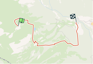
Ovronnaz Descente de Jorasse par Odonne

jjrochat
User

Length
3.3 km

Max alt
1946 m

Uphill gradient
4 m
Km-Effort
5.2 km

Min alt
1388 m

Downhill gradient
551 m
Boucle
No
Creation date :
2014-12-11 00:00:00.0
Updated on :
2014-12-11 00:00:00.0
--
Difficulty : Unknown

FREE GPS app for hiking
 SityTrail
IGN / Geographical institutes
SityTrail Plus
The world is yours!
About
Trail Other activity of 3.3 km to be discovered at Valais/Wallis, Martigny, Leytron. This trail is proposed by jjrochat.
Description
Descente à pied depuis le sommet du télésiège jusqu''au parking, en passant par Odonne
Positioning
Country:
Switzerland
Region :
Valais/Wallis
Department/Province :
Martigny
Municipality :
Leytron
Location:
Unknown
Start:(Dec)
Start:(UTM)
356619 ; 5118355 (32T) N.
Comments