


Praz-de-Lys - Lac de Roy

so.duchateau
User

Length
7.4 km

Max alt
1687 m

Uphill gradient
285 m
Km-Effort
11.2 km

Min alt
1429 m

Downhill gradient
282 m
Boucle
Yes
Creation date :
2020-07-17 12:18:08.0
Updated on :
2020-07-17 14:39:14.187
2h19
Difficulty : Medium

FREE GPS app for hiking
 SityTrail
IGN / Geographical institutes
SityTrail Plus
The world is yours!
About
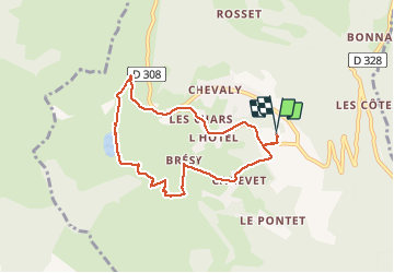
Trail Walking of 7.4 km to be discovered at Auvergne-Rhône-Alpes, Upper Savoy, Taninges. This trail is proposed by so.duchateau.
Positioning
Country:
France
Region :
Auvergne-Rhône-Alpes
Department/Province :
Upper Savoy
Municipality :
Taninges
Location:
Unknown
Start:(Dec)
Start:(UTM)
314628 ; 5112877 (32T) N.
Comments