Trail Walking Carqueiranne - 
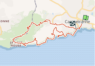
boucle depuis Carquierane - Photo
 cousam
cousam

User

© OpenStreetMap contributors
Length
Length
14.3 km
Max alt
Max alt
283 m
Uphill gradient
Uphill gradient
451 m
Km-Effort
Km-Effort  
20 km
Min alt
Min alt
-1 m
Downhill gradient
Downhill gradient
454 m
Boucle
Boucle
No
Creation date :
2020-07-18 07:48:09.577
Updated on :
2021-04-12 18:25:30.221

(0 Reviews)

Walking
Walking
3h53
Difficulty : Very easy

Scan this QR Code to open this trail in the SityTrail application

FREE GPS app for hiking

Logo SityTrail SityTrail

IGN / Geographical institutes

Download SityTrail from the App Store Download SityTrail from Google Play

Logo SityTrail SityTrail Plus

The world is yours!

Download SityTrail from the App Store Download SityTrail from Google Play Download SityTrail on Huawei AppGallery

About

Trail Walking of 14.3 km to be discovered at Provence-Alpes-Côte d'Azur, Var, Carqueiranne. This trail is proposed by cousam.

Description

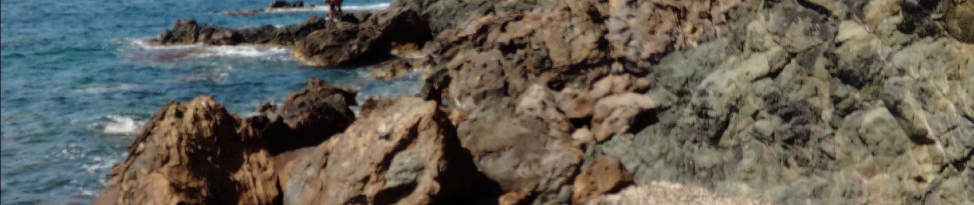
Le sentier litoral (marqué PR variante sur la carte et le guide sentier du littoral 2018) n'existe plus. Ce sont des propriétées privées.
La partie après la mine est bien passé part les forts Gavaresse, Collé Noir, et de la Bayarde.

Elevation profile

Photos

Positioning

Country:
France
Region :
Provence-Alpes-Côte d'Azur
Department/Province :
Var
Municipality :
Carqueiranne
Location:
Unknown
Start:(UTM)
262304 ; 4774945 (32T) N.


Close
My subscriptions