


Lac d'Ourrec de Hautacan

lph.engelmann
User

Length
12.5 km

Max alt
1879 m

Uphill gradient
482 m
Km-Effort
19 km

Min alt
1618 m

Downhill gradient
519 m
Boucle
No
Creation date :
2020-07-16 09:05:33.268
Updated on :
2020-07-18 19:43:15.613
5h09
Difficulty : Medium

FREE GPS app for hiking
 SityTrail
IGN / Geographical institutes
SityTrail Plus
The world is yours!
About
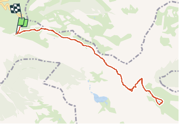
Trail Walking of 12.5 km to be discovered at Occitania, Hautespyrenees, Beaucens. This trail is proposed by lph.engelmann.
Positioning
Country:
France
Region :
Occitania
Department/Province :
Hautespyrenees
Municipality :
Beaucens
Location:
Unknown
Start:(Dec)
Start:(UTM)
744198 ; 4761589 (30T) N.
Comments