


l'espionne à Magenta G3 fait

LouisROGER
User GUIDE
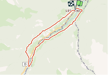

Length
8.9 km

Max alt
1014 m

Uphill gradient
316 m
Km-Effort
13.1 km

Min alt
743 m

Downhill gradient
314 m
Boucle
Yes
Creation date :
2020-07-17 07:31:19.123
Updated on :
2020-07-20 08:25:56.139
4h27
Difficulty : Very easy

FREE GPS app for hiking
 SityTrail
IGN / Geographical institutes
SityTrail Plus
The world is yours!
About
Trail Walking of 8.9 km to be discovered at Occitania, Hautespyrenees, Beaudéan. This trail is proposed by LouisROGER.
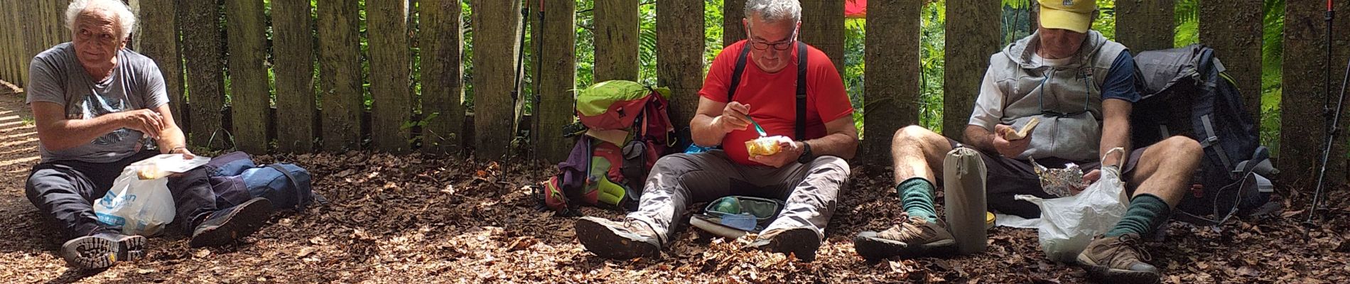
Photos

Positioning
Country:
France
Region :
Occitania
Department/Province :
Hautespyrenees
Municipality :
Beaudéan
Location:
Unknown
Start:(Dec)
Start:(UTM)
266800 ; 4765499 (31T) N.
Comments