Trail Walking Massat - mardi 21 juillet 2020  - Photo

mardi 21 juillet 2020

 CAMBON
CAMBON

User

© OpenStreetMap contributors
Length
Length
7.1 km
Max alt
Max alt
803 m
Uphill gradient
Uphill gradient
248 m
Km-Effort
Km-Effort  
10.4 km
Min alt
Min alt
627 m
Downhill gradient
Downhill gradient
248 m
Boucle
Boucle
Yes
Creation date :
2020-07-21 08:45:27.488
Updated on :
2020-07-30 14:24:24.329

(0 Reviews)

Walking
Walking
3h21
Difficulty : Easy

Scan this QR Code to open this trail in the SityTrail application

FREE GPS app for hiking

Logo SityTrail SityTrail

IGN / Geographical institutes

Download SityTrail from the App Store Download SityTrail from Google Play

Logo SityTrail SityTrail World

The world is yours!

Download SityTrail from the App Store Download SityTrail from Google Play Download SityTrail on Huawei AppGallery

About

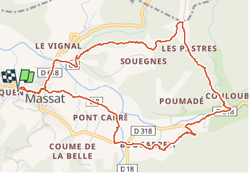
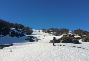
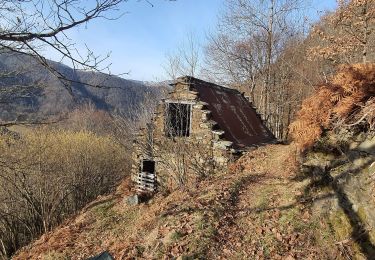
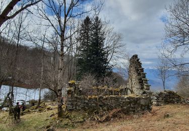
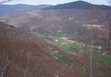
Trail Walking of 7.1 km to be discovered at Occitania, Ariège, Massat. This trail is proposed by CAMBON.
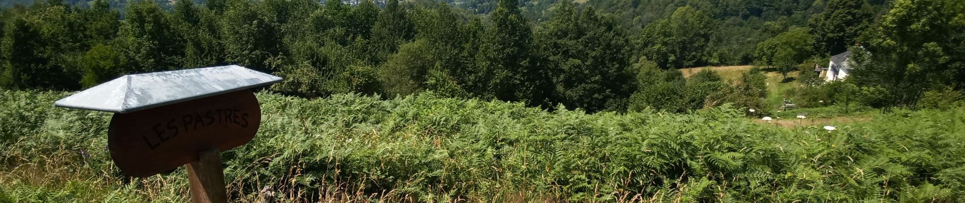
Description

CHEMIN DES PASTRES
Départ sur le parking ombragé devant l'écolle de MASSAT

Elevation profile

Photos

Positioning

Country:
France
Region :
Occitania
Department/Province :
Ariège
Municipality :
Massat
Location:
Unknown
Start:(UTM)
364836 ; 4749872 (31T) N.

Trails nearby

Trail Walking Biert - Boucle de Ouert (n°14) - Photo
Walking
chrisgps

Walking

Very easy
Biert, Occitania, Ariège, France
12 km | 20 km-effort
5h 54min
Yes
Trail Walking Le Port - les plagnols depuis foullie - Photo
Walking
chrisgps

Walking

Very easy
Le Port, Occitania, Ariège, France
12.7 km | 23 km-effort
6h 0min
Yes
Trail Snowshoes Le Port - RQ-Hameau de Goutets - Photo
Snowshoes
Polo-31

Snowshoes

Easy
Le Port, Occitania, Ariège, France
10.2 km | 16.9 km-effort
4h 0min
Yes
Trail Walking Le Port - les Plagnols depuis la Foullie - Photo
Walking
chrisgps

Walking

Medium
Le Port, Occitania, Ariège, France
12.7 km | 23 km-effort
6h 0min
Yes
Trail Walking Le Port - le hameau des granges de Goutets - Photo
Walking
chrisgps

Walking

Difficult
Le Port, Occitania, Ariège, France
9.8 km | 16.7 km-effort
3h 48min
Yes
Trail Walking Ercé - Tuc de la Coume en boucle (2ème) - Photo
Walking
chrisgps

Walking

Medium
Ercé, Occitania, Ariège, France
10.4 km | 21 km-effort
6h 12min
Yes
Trail Mountain bike Ercé - Les Estives d'Ercé - Photo
Mountain bike
tracegps

Mountain bike

Medium
Ercé, Occitania, Ariège, France
10.9 km | 18.9 km-effort
2h 0min
Yes
Trail Walking Ercé - Les Estives d'Ercé - Photo
Walking
tracegps

Walking

Medium
Ercé, Occitania, Ariège, France
10.9 km | 18.9 km-effort
4h 0min
Yes
Trail Equestrian Biert - Boucle en Haut-Couserans - Biert - Oust - Photo
Equestrian
tracegps

Equestrian

Difficult
Biert, Occitania, Ariège, France
15.5 km | 24 km-effort
1h 30min
No


Close
My subscriptions