


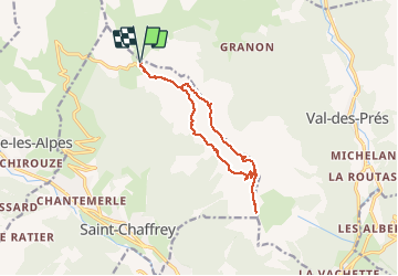
les crêtes de Peyrolles

amiral13
User GUIDE

Length
13 km

Max alt
2624 m

Uphill gradient
592 m
Km-Effort
21 km

Min alt
2305 m

Downhill gradient
593 m
Boucle
Yes
Creation date :
2020-07-23 08:22:08.618
Updated on :
2020-07-23 15:08:42.556
5h20
Difficulty : Easy

FREE GPS app for hiking
 SityTrail
IGN / Geographical institutes
SityTrail Plus
The world is yours!
About
Trail Walking of 13 km to be discovered at Provence-Alpes-Côte d'Azur, Hautes-Alpes, Saint-Chaffrey. This trail is proposed by amiral13.
Photos


Positioning
Country:
France
Region :
Provence-Alpes-Côte d'Azur
Department/Province :
Hautes-Alpes
Municipality :
Saint-Chaffrey
Location:
Unknown
Start:(Dec)
Start:(UTM)
311618 ; 4981631 (32T) N.
Comments