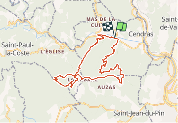
30 - SAINT PAUL LA COSTE - Galeizon - 18.6 Km - 07h30 - D 800 m

dansmabulle
User

Length
18.6 km

Max alt
559 m

Uphill gradient
723 m
Km-Effort
28 km

Min alt
158 m

Downhill gradient
723 m
Boucle
Yes
Creation date :
2014-12-10 00:00:00.0
Updated on :
2014-12-10 00:00:00.0
6h03
Difficulty : Difficult

FREE GPS app for hiking
 SityTrail
IGN / Geographical institutes
SityTrail Plus
The world is yours!
About
Trail Walking of 18.6 km to be discovered at Occitania, Gard, Cendras. This trail is proposed by dansmabulle.
Positioning
Country:
France
Region :
Occitania
Department/Province :
Gard
Municipality :
Cendras
Location:
Unknown
Start:(Dec)
Start:(UTM)
582942 ; 4889558 (31T) N.
Comments