


Mandeure. laumont

tiene
User
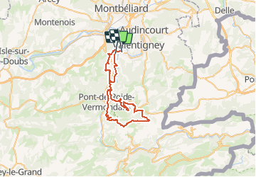

Length
47 km

Max alt
834 m

Uphill gradient
1245 m
Km-Effort
64 km

Min alt
330 m

Downhill gradient
1247 m
Boucle
No
Creation date :
2020-07-25 06:33:24.035
Updated on :
2020-07-25 10:33:14.872
3h59
Difficulty : Very easy

FREE GPS app for hiking
 SityTrail
IGN / Geographical institutes
SityTrail Plus
The world is yours!
About
Trail Mountain bike of 47 km to be discovered at Bourgogne-Franche-Comté, Doubs, Mathay. This trail is proposed by tiene.
Positioning
Country:
France
Region :
Bourgogne-Franche-Comté
Department/Province :
Doubs
Municipality :
Mathay
Location:
Unknown
Start:(Dec)
Start:(UTM)
333221 ; 5257599 (32T) N.
Comments