


ravine des cabris

funkady
User

Length
9.6 km

Max alt
108 m

Uphill gradient
113 m
Km-Effort
11.1 km

Min alt
43 m

Downhill gradient
113 m
Boucle
Yes
Creation date :
2020-07-25 13:27:05.946
Updated on :
2020-07-25 14:46:45.813
1h00
Difficulty : Very easy

FREE GPS app for hiking
 SityTrail
IGN / Geographical institutes
SityTrail Plus
The world is yours!
About
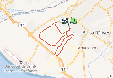
Trail Running of 9.6 km to be discovered at Réunion, Unknown, Saint-Pierre. This trail is proposed by funkady.
Positioning
Country:
France
Region :
Réunion
Department/Province :
Unknown
Municipality :
Saint-Pierre
Location:
Unknown
Start:(Dec)
Start:(UTM)
339217 ; 7643648 (40K) S.
Comments