


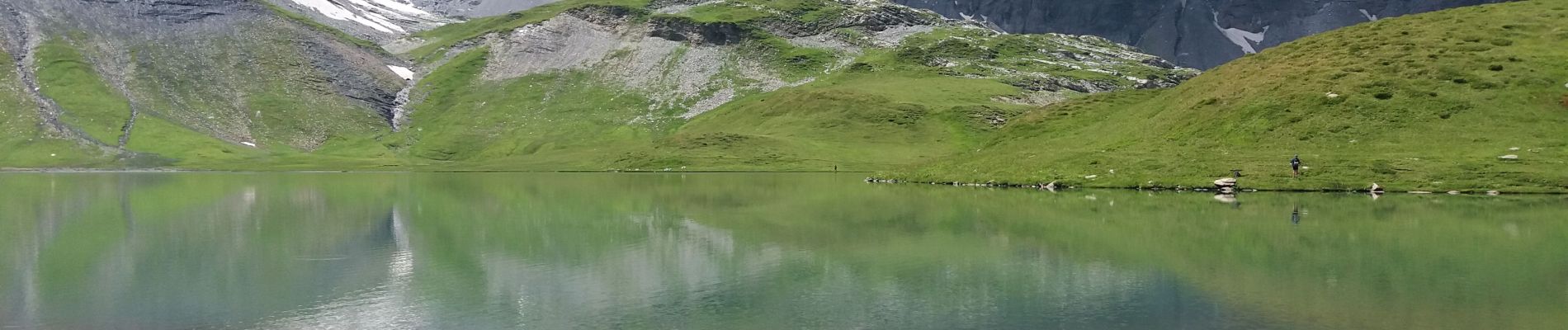
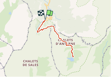
SIXT-PASSY RESERVE: LAC D'ANTERNE

djeepee74
User

Length
15.9 km

Max alt
2119 m

Uphill gradient
1103 m
Km-Effort
31 km

Min alt
1158 m

Downhill gradient
1101 m
Boucle
Yes
Creation date :
2020-07-25 07:03:10.967
Updated on :
2020-07-26 12:33:35.688
6h15
Difficulty : Difficult

FREE GPS app for hiking
 SityTrail
IGN / Geographical institutes
SityTrail Plus
The world is yours!
About
Trail Walking of 15.9 km to be discovered at Auvergne-Rhône-Alpes, Upper Savoy, Sixt-Fer-à-Cheval. This trail is proposed by djeepee74.
Description
Aller / Retour... en live le 20200725
A partir du lac, on peut poursuivre jusqu'au col d'Anterne... à 30 mn.
Photos


Positioning
Country:
France
Region :
Auvergne-Rhône-Alpes
Department/Province :
Upper Savoy
Municipality :
Sixt-Fer-à-Cheval
Location:
Unknown
Start:(Dec)
Start:(UTM)
327295 ; 5098901 (32T) N.
Comments