


désert plate par derogoir

Bernadette Noirant
User
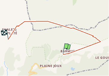

Length
6.6 km

Max alt
2389 m

Uphill gradient
910 m
Km-Effort
17.2 km

Min alt
1565 m

Downhill gradient
472 m
Boucle
No
Creation date :
2020-07-26 08:19:25.144
Updated on :
2020-07-26 14:57:20.52
6h37
Difficulty : Difficult

FREE GPS app for hiking
 SityTrail
IGN / Geographical institutes
SityTrail Plus
The world is yours!
About
Trail Walking of 6.6 km to be discovered at Auvergne-Rhône-Alpes, Upper Savoy, Passy. This trail is proposed by Bernadette Noirant.
Description
Très beau mais passage aérien,
Positioning
Country:
France
Region :
Auvergne-Rhône-Alpes
Department/Province :
Upper Savoy
Municipality :
Passy
Location:
Unknown
Start:(Dec)
Start:(UTM)
325467 ; 5091643 (32T) N.
Comments