


Mettray - Dolmen - 12.9km 160m 2h40 - 2020 07 26

Orcal37
User GUIDE

Length
12.9 km

Max alt
100 m

Uphill gradient
161 m
Km-Effort
15 km

Min alt
51 m

Downhill gradient
163 m
Boucle
Yes
Creation date :
2020-07-26 12:25:00.672
Updated on :
2020-07-27 09:43:37.254
2h40
Difficulty : Easy

FREE GPS app for hiking
 SityTrail
IGN / Geographical institutes
SityTrail Plus
The world is yours!
About
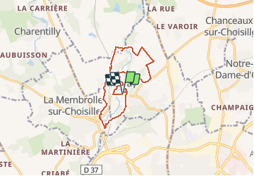
Trail Walking of 12.9 km to be discovered at Centre-Loire Valley, Indre-et-Loire, Mettray. This trail is proposed by Orcal37.
Description
Mettray - Dolmen de la Grotte aux Fées - plan d'eau de La Membrolle-sur-Choisille - 12.9km 160m 2h40 - 2020 07 26
Photos


Positioning
Country:
France
Region :
Centre-Loire Valley
Department/Province :
Indre-et-Loire
Municipality :
Mettray
Location:
Unknown
Start:(Dec)
Start:(UTM)
322892 ; 5257705 (31T) N.
Comments