


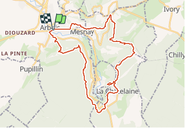
Arbois_La Chatelaine 20200727

cmike39
User

Length
21 km

Max alt
583 m

Uphill gradient
569 m
Km-Effort
29 km

Min alt
290 m

Downhill gradient
570 m
Boucle
Yes
Creation date :
2020-07-27 06:37:18.88
Updated on :
2020-07-27 15:03:16.008
5h46
Difficulty : Very easy

FREE GPS app for hiking
 SityTrail
IGN / Geographical institutes
SityTrail Plus
The world is yours!
About
Trail Walking of 21 km to be discovered at Bourgogne-Franche-Comté, Jura, Arbois. This trail is proposed by cmike39.
Positioning
Country:
France
Region :
Bourgogne-Franche-Comté
Department/Province :
Jura
Municipality :
Arbois
Location:
Unknown
Start:(Dec)
Start:(UTM)
711369 ; 5198004 (31T) N.
Comments