


20200727 Le signal

Childebert
User

Length
4.1 km

Max alt
2206 m

Uphill gradient
427 m
Km-Effort
9.4 km

Min alt
1771 m

Downhill gradient
295 m
Boucle
Yes
Creation date :
2020-07-27 10:22:27.044
Updated on :
2020-07-27 15:43:20.411
3h16
Difficulty : Difficult

FREE GPS app for hiking
 SityTrail
IGN / Geographical institutes
SityTrail Plus
The world is yours!
About
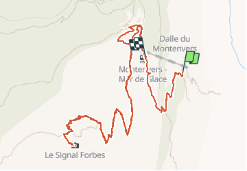
Trail Walking of 4.1 km to be discovered at Auvergne-Rhône-Alpes, Upper Savoy, Chamonix-Mont-Blanc. This trail is proposed by Childebert.
Positioning
Country:
France
Region :
Auvergne-Rhône-Alpes
Department/Province :
Upper Savoy
Municipality :
Chamonix-Mont-Blanc
Location:
Unknown
Start:(Dec)
Start:(UTM)
338735 ; 5088501 (32T) N.
Comments