


Refuge de Boret

GioA10
User
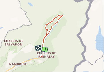

Length
11.5 km

Max alt
1403 m

Uphill gradient
615 m
Km-Effort
19.7 km

Min alt
959 m

Downhill gradient
606 m
Boucle
No
Creation date :
2020-07-27 09:04:00.0
Updated on :
2020-07-28 08:30:18.754
4h30
Difficulty : Difficult

FREE GPS app for hiking
 SityTrail
IGN / Geographical institutes
SityTrail Plus
The world is yours!
About
Trail Walking of 11.5 km to be discovered at Auvergne-Rhône-Alpes, Upper Savoy, Sixt-Fer-à-Cheval. This trail is proposed by GioA10.
Positioning
Country:
France
Region :
Auvergne-Rhône-Alpes
Department/Province :
Upper Savoy
Municipality :
Sixt-Fer-à-Cheval
Location:
Unknown
Start:(Dec)
Start:(UTM)
332890 ; 5104955 (32T) N.
Comments