


Le champ de bataille de la Chapelotte

VacheKiri67
User


3h12
Difficulty : Medium

FREE GPS app for hiking
 SityTrail
IGN / Geographical institutes
SityTrail Plus
The world is yours!
About
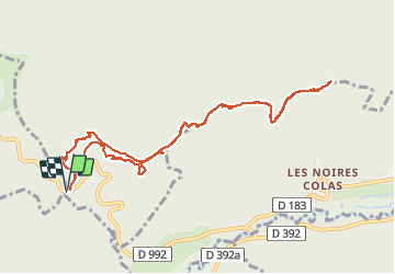
Trail Walking of 10.4 km to be discovered at Grand Est, Meurthe-et-Moselle, Angomont. This trail is proposed by VacheKiri67.
Description
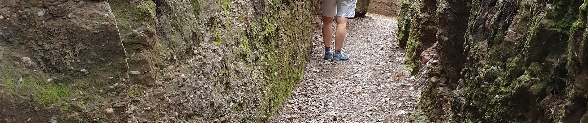
Faite le 28/07/2020. D'après "Passion Vosges - Sentiers de mémoire de la Grande Guerre " N°5 : Le champ de bataille de la Chapelotte. Durée indiquée pour le circuit : 4h00. Départ : parking du col de la Chapelotte. Circuit historique bien balisé avec un balisage spécifique et de nombreux panneaux explicatifs. Le parcours des "boyaux" est vraiment très intéressant et prenant.
Photos


50 photos in total. Please click on a photo to see them all in the gallery.
Positioning
Comments