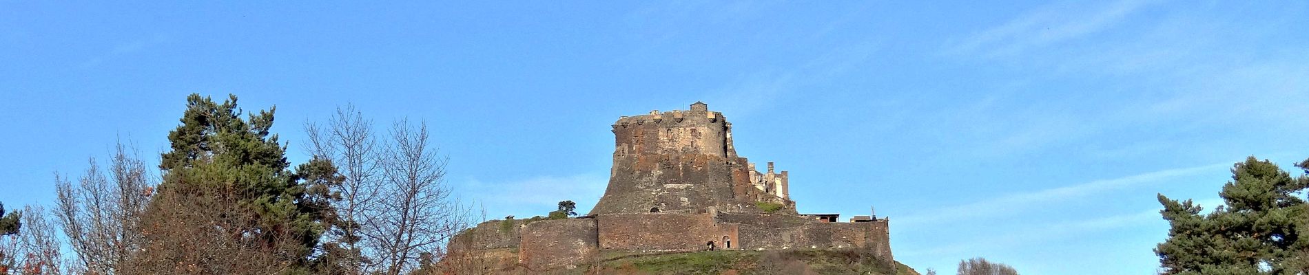
Murol_Marais_Chambon

jagarnier
User GUIDE
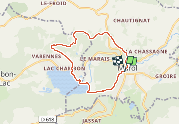

Length
7 km

Max alt
1069 m

Uphill gradient
294 m
Km-Effort
10.9 km

Min alt
832 m

Downhill gradient
291 m
Boucle
Yes
Creation date :
2020-07-29 08:58:43.444
Updated on :
2024-06-01 12:51:17.859
2h00
Difficulty : Medium

FREE GPS app for hiking
 SityTrail
IGN / Geographical institutes
SityTrail Plus
The world is yours!
About
Trail Walking of 7 km to be discovered at Auvergne-Rhône-Alpes, Puy-de-Dôme, Murol. This trail is proposed by jagarnier.
Photos

Positioning
Country:
France
Region :
Auvergne-Rhône-Alpes
Department/Province :
Puy-de-Dôme
Municipality :
Murol
Location:
Unknown
Start:(Dec)
Start:(UTM)
495458 ; 5046592 (31T) N.
Comments