


Sommet d'Antenac (1990m) depuis Mayrègne

sga31
User
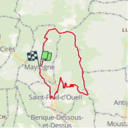

Length
15.3 km

Max alt
1980 m

Uphill gradient
940 m
Km-Effort
28 km

Min alt
1083 m

Downhill gradient
946 m
Boucle
Yes
Creation date :
2014-12-10 00:00:00.0
Updated on :
2014-12-10 00:00:00.0
5h45
Difficulty : Medium

FREE GPS app for hiking
 SityTrail
IGN / Geographical institutes
SityTrail Plus
The world is yours!
About
Trail Walking of 15.3 km to be discovered at Occitania, Haute-Garonne, Mayrègne. This trail is proposed by sga31.
Description
Une belle randonnée réalisée presque entièrement à découvert, avec un long et magnifique parcours de crête.A savourer été comme hiver, les larges crêtes se prêtant bien à la pratique des raquettes.


Positioning
Country:
France
Region :
Occitania
Department/Province :
Haute-Garonne
Municipality :
Mayrègne
Location:
Unknown
Start:(Dec)
Start:(UTM)
298981 ; 4746373 (31T) N.
Comments