


3007

Liebeaux
User

Length
16.1 km

Max alt
2484 m

Uphill gradient
1315 m
Km-Effort
34 km

Min alt
1379 m

Downhill gradient
1312 m
Boucle
Yes
Creation date :
2020-07-30 05:25:27.684
Updated on :
2020-07-30 17:11:05.847
9h04
Difficulty : Very easy

FREE GPS app for hiking
 SityTrail
IGN / Geographical institutes
SityTrail Plus
The world is yours!
About
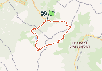
Trail Walking of 16.1 km to be discovered at Auvergne-Rhône-Alpes, Isère, Laval-en-Belledonne. This trail is proposed by Liebeaux.
Positioning
Country:
France
Region :
Auvergne-Rhône-Alpes
Department/Province :
Isère
Municipality :
Laval-en-Belledonne
Location:
Unknown
Start:(Dec)
Start:(UTM)
264583 ; 5012190 (32T) N.
Comments