


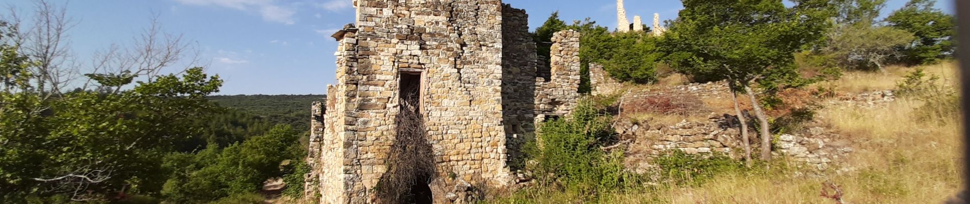
MONTLAUX. Le Revest. La Blache . Vieux Montlaux o l s

RobinMicheline
User GUIDE
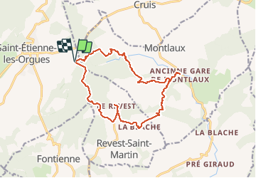

Length
17.3 km

Max alt
788 m

Uphill gradient
453 m
Km-Effort
23 km

Min alt
537 m

Downhill gradient
453 m
Boucle
Yes
Creation date :
2020-07-31 04:28:22.303
Updated on :
2020-07-31 13:00:25.216
4h39
Difficulty : Medium

FREE GPS app for hiking
 SityTrail
IGN / Geographical institutes
SityTrail Plus
The world is yours!
About
Trail Walking of 17.3 km to be discovered at Provence-Alpes-Côte d'Azur, Alpes-de-Haute-Provence, Saint-Étienne-les-Orgues. This trail is proposed by RobinMicheline.
Description
vieux Montlaux , la Blache et le Revest magnifiques bien suivre trace
Photos


Positioning
Country:
France
Region :
Provence-Alpes-Côte d'Azur
Department/Province :
Alpes-de-Haute-Provence
Municipality :
Saint-Étienne-les-Orgues
Location:
Unknown
Start:(Dec)
Start:(UTM)
724514 ; 4880376 (31T) N.
Comments