


Grèce

GOHIER
User
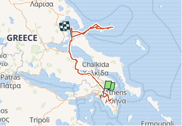

Length
438 km

Max alt
1220 m

Uphill gradient
8359 m
Km-Effort
550 km

Min alt
-4 m

Downhill gradient
8490 m
Boucle
No
Creation date :
2020-07-25 12:48:00.0
Updated on :
2020-08-01 11:32:49.89
12h49
Difficulty : Unknown

FREE GPS app for hiking
 SityTrail
IGN / Geographical institutes
SityTrail Plus
The world is yours!
About
Trail Canoe - kayak of 438 km to be discovered at Attica, Regional Unit of Central Athens. This trail is proposed by GOHIER.
Positioning
Country:
Greece
Region :
Attica
Department/Province :
Regional Unit of Central Athens
Municipality :
Αθήνα
Location:
Unknown
Start:(Dec)
Start:(UTM)
742022 ; 4207339 (34S) N.
Comments