


Boucle Besse, lac pavin, Besse

fbienmuller
User

Length
80 km

Max alt
1275 m

Uphill gradient
910 m
Km-Effort
94 km

Min alt
320 m

Downhill gradient
1540 m
Boucle
No
Creation date :
2020-08-02 08:56:11.52
Updated on :
2020-08-02 14:30:41.583
4h35
Difficulty : Easy

FREE GPS app for hiking
 SityTrail
IGN / Geographical institutes
SityTrail Plus
The world is yours!
About
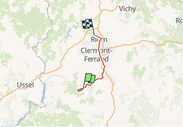
Trail Walking of 80 km to be discovered at Auvergne-Rhône-Alpes, Puy-de-Dôme, Besse-et-Saint-Anastaise. This trail is proposed by fbienmuller.
Photos


Positioning
Country:
France
Region :
Auvergne-Rhône-Alpes
Department/Province :
Puy-de-Dôme
Municipality :
Besse-et-Saint-Anastaise
Location:
Besse
Start:(Dec)
Start:(UTM)
494984 ; 5039485 (31T) N.
Comments