


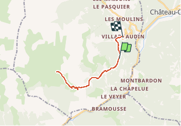
Refuge de Guérande apd Villardgaudin

dridri002
User

Length
13.1 km

Max alt
2288 m

Uphill gradient
587 m
Km-Effort
22 km

Min alt
1593 m

Downhill gradient
892 m
Boucle
No
Creation date :
2020-08-02 10:17:07.759
Updated on :
2020-08-02 17:51:37.135
3h23
Difficulty : Medium

FREE GPS app for hiking
 SityTrail
IGN / Geographical institutes
SityTrail Plus
The world is yours!
About
Trail Walking of 13.1 km to be discovered at Provence-Alpes-Côte d'Azur, Hautes-Alpes, Arvieux. This trail is proposed by dridri002.
Positioning
Country:
France
Region :
Provence-Alpes-Côte d'Azur
Department/Province :
Hautes-Alpes
Municipality :
Arvieux
Location:
Unknown
Start:(Dec)
Start:(UTM)
322241 ; 4955852 (32T) N.
Comments