


Florac - Saint Germain de Calberte 2020

JeanPierreNancy
User
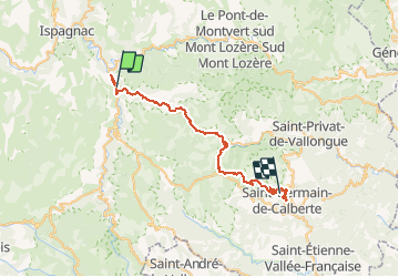

Length
44 km

Max alt
1036 m

Uphill gradient
1305 m
Km-Effort
61 km

Min alt
470 m

Downhill gradient
1117 m
Boucle
No
Creation date :
2020-08-02 06:59:22.406
Updated on :
2020-08-09 07:03:57.459
5h17
Difficulty : Medium

FREE GPS app for hiking
 SityTrail
IGN / Geographical institutes
SityTrail Plus
The world is yours!
About
Trail Mountain bike of 44 km to be discovered at Occitania, Lozère, Florac Trois Rivières. This trail is proposed by JeanPierreNancy.
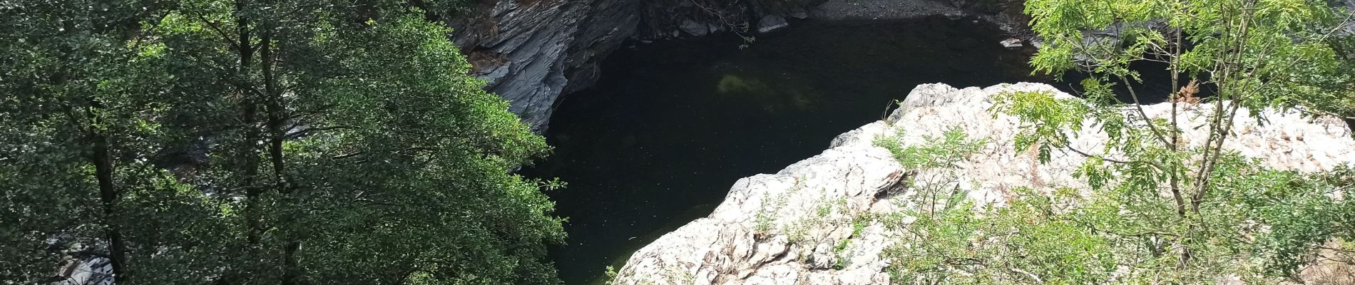
Photos


Positioning
Country:
France
Region :
Occitania
Department/Province :
Lozère
Municipality :
Florac Trois Rivières
Location:
Florac
Start:(Dec)
Start:(UTM)
547701 ; 4907477 (31T) N.
Comments