


La Sure

jphugon
User

Length
12.1 km

Max alt
1643 m

Uphill gradient
670 m
Km-Effort
21 km

Min alt
1367 m

Downhill gradient
678 m
Boucle
Yes
Creation date :
2020-08-03 09:16:16.922
Updated on :
2020-08-03 09:17:45.342
--
Difficulty : Medium

FREE GPS app for hiking
 SityTrail
IGN / Geographical institutes
SityTrail Plus
The world is yours!
About
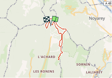
Trail On foot of 12.1 km to be discovered at Auvergne-Rhône-Alpes, Isère, Autrans-Méaudre en Vercors. This trail is proposed by jphugon.
Description
depart pkg tunel du Mortier
Positioning
Country:
France
Region :
Auvergne-Rhône-Alpes
Department/Province :
Isère
Municipality :
Autrans-Méaudre en Vercors
Location:
Autrans
Start:(Dec)
Start:(UTM)
702600 ; 5012594 (31T) N.
Comments