


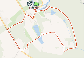
Boucle de l'Abbaye d'Aulne (Thuin)

crabbenadine
User

Length
5.9 km

Max alt
192 m

Uphill gradient
126 m
Km-Effort
7.6 km

Min alt
110 m

Downhill gradient
127 m
Boucle
Yes
Creation date :
2020-08-03 16:22:07.298
Updated on :
2020-08-03 16:25:10.797
--
Difficulty : Easy

FREE GPS app for hiking
 SityTrail
IGN / Geographical institutes
SityTrail Plus
The world is yours!
About
Trail On foot of 5.9 km to be discovered at Wallonia, Hainaut, Thuin. This trail is proposed by crabbenadine.
Description
Petite balade de 6 km au départ de l'Abbaye et retour.
Positioning
Country:
Belgium
Region :
Wallonia
Department/Province :
Hainaut
Municipality :
Thuin
Location:
Gozée
Start:(Dec)
Start:(UTM)
594761 ; 5580222 (31U) N.
Comments