


Sixt fer à cheval

jeff2
User
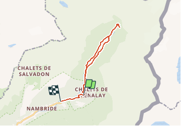

Length
12.1 km

Max alt
1291 m

Uphill gradient
418 m
Km-Effort
17.9 km

Min alt
879 m

Downhill gradient
499 m
Boucle
No
Creation date :
2020-08-05 08:31:49.975
Updated on :
2020-08-05 17:42:15.23
3h37
Difficulty : Very easy

FREE GPS app for hiking
 SityTrail
IGN / Geographical institutes
SityTrail Plus
The world is yours!
About
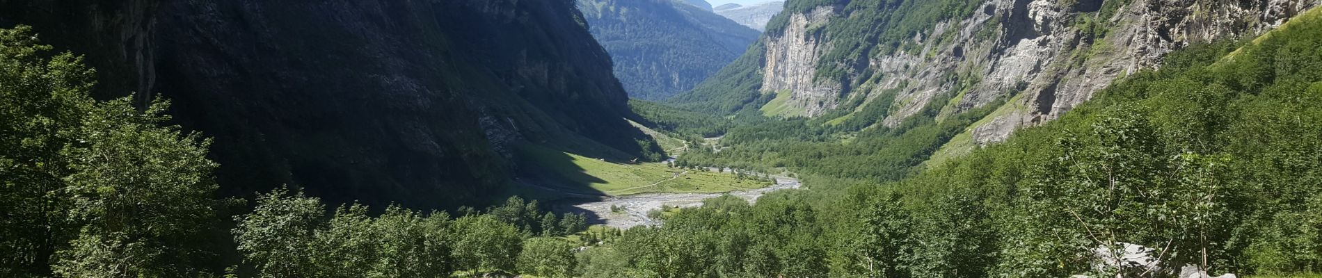
Trail Fishing of 12.1 km to be discovered at Auvergne-Rhône-Alpes, Upper Savoy, Sixt-Fer-à-Cheval. This trail is proposed by jeff2.
Description
Jolie balade
Photos


Positioning
Country:
France
Region :
Auvergne-Rhône-Alpes
Department/Province :
Upper Savoy
Municipality :
Sixt-Fer-à-Cheval
Location:
Unknown
Start:(Dec)
Start:(UTM)
333003 ; 5104901 (32T) N.
Comments