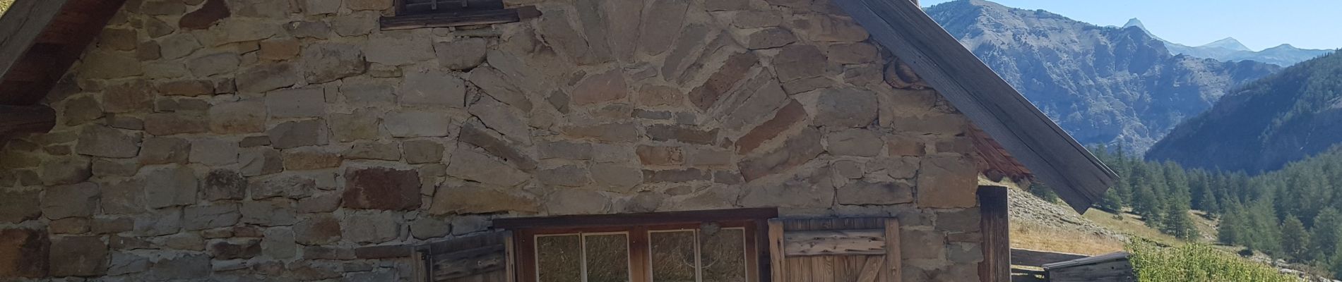
Trail Walking Villars-Colmars - Bergerie de Juan - Photo
 soca
soca

User

© OpenStreetMap contributors
Length
Length
9.2 km
Max alt
Max alt
1862 m
Uphill gradient
Uphill gradient
543 m
Km-Effort
Km-Effort  
16.4 km
Min alt
Min alt
1404 m
Downhill gradient
Downhill gradient
534 m
Boucle
Boucle
Yes
Creation date :
2020-08-06 07:05:54.943
Updated on :
2020-08-06 14:53:22.25

(0 Reviews)

Walking
Walking
3h41
Difficulty : Easy

Scan this QR Code to open this trail in the SityTrail application

FREE GPS app for hiking

Logo SityTrail SityTrail

IGN / Geographical institutes

Download SityTrail from the App Store Download SityTrail from Google Play

Logo SityTrail SityTrail Plus

The world is yours!

Download SityTrail from the App Store Download SityTrail from Google Play Download SityTrail on Huawei AppGallery

About

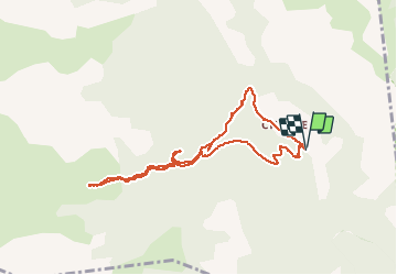
Trail Walking of 9.2 km to be discovered at Provence-Alpes-Côte d'Azur, Alpes-de-Haute-Provence, Villars-Colmars. This trail is proposed by soca.

Description

Départ après le pont de Chasse. Courte montée un peu raide à travers les sapins, puis chemin en pente douce  jusqu'à la bergerie.
Le retour vers le puy agréable jusqu'à la rencontre avec la piste qui a été refaite au bull : épouvantable.
Mieux vaut revenir sur ses pas vers le pont de chasse.

Elevation profile

Photos

Positioning

Country:
France
Region :
Provence-Alpes-Côte d'Azur
Department/Province :
Alpes-de-Haute-Provence
Municipality :
Villars-Colmars
Location:
Unknown
Start:(UTM)
307350 ; 4895052 (32T) N.


Close
My subscriptions