


Autour du bussant

jmbilger
User
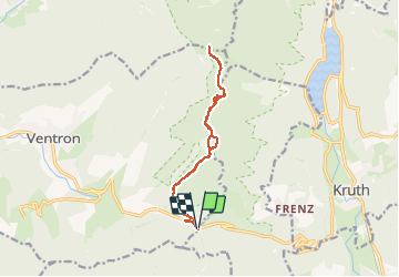

Length
13.7 km

Max alt
1167 m

Uphill gradient
436 m
Km-Effort
19.5 km

Min alt
877 m

Downhill gradient
438 m
Boucle
Yes
Creation date :
2020-08-06 08:29:52.0
Updated on :
2020-08-06 14:51:22.11
5h06
Difficulty : Unknown

FREE GPS app for hiking
 SityTrail
IGN / Geographical institutes
SityTrail Plus
The world is yours!
About
Trail Walking of 13.7 km to be discovered at Grand Est, Vosges, Ventron. This trail is proposed by jmbilger.
Photos

Positioning
Country:
France
Region :
Grand Est
Department/Province :
Vosges
Municipality :
Ventron
Location:
Unknown
Start:(Dec)
Start:(UTM)
344408 ; 5309806 (32T) N.
Comments