


Chasse - cabane joyeux

soca
User
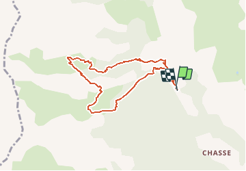

Length
7.8 km

Max alt
2054 m

Uphill gradient
527 m
Km-Effort
14.8 km

Min alt
1527 m

Downhill gradient
531 m
Boucle
Yes
Creation date :
2020-08-07 17:36:27.746
Updated on :
2020-08-07 17:40:24.111
2h58
Difficulty : Medium

FREE GPS app for hiking
 SityTrail
IGN / Geographical institutes
SityTrail Plus
The world is yours!
About
Trail Walking of 7.8 km to be discovered at Provence-Alpes-Côte d'Azur, Alpes-de-Haute-Provence, Villars-Colmars. This trail is proposed by soca.
Description
Départ piste fond de chasse . Cabane de Chabaud - Cabane de joyeux - Les Sagnes; retour.
Positioning
Country:
France
Region :
Provence-Alpes-Côte d'Azur
Department/Province :
Alpes-de-Haute-Provence
Municipality :
Villars-Colmars
Location:
Unknown
Start:(Dec)
Start:(UTM)
306309 ; 4896669 (32T) N.
Comments