


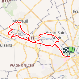


9.6 km | 10.6 km-effort


User


FREE GPS app for hiking
 SityTrail
IGN / Geographical institutes
SityTrail World
The world is yours!
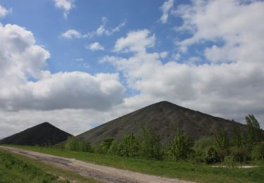
Trail Mountain bike of 15.6 km to be discovered at Hauts-de-France, Pas-de-Calais, Sainte-Catherine. This trail is proposed by capinsolite.
Au départ de l''agence de voyages Cap Insolite, une petite heure de ballade facile... en VTT. Du GR 121 au GR 127.


Walking
Walking

On foot

Walking
Walking
Walking
Walking
Walking
Walking