


2020-08-10_07h11m47_-1492964215

ARVIEU
User

Length
32 km

Max alt
332 m

Uphill gradient
541 m
Km-Effort
39 km

Min alt
82 m

Downhill gradient
542 m
Boucle
Yes
Creation date :
2020-08-10 05:11:47.749
Updated on :
2020-08-10 05:19:59.871
2h33
Difficulty : Difficult

FREE GPS app for hiking
 SityTrail
IGN / Geographical institutes
SityTrail Plus
The world is yours!
About
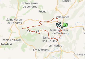
Trail Mountain bike of 32 km to be discovered at Occitania, Hérault, Saint-Mathieu-de-Tréviers. This trail is proposed by ARVIEU.
Description
Tour du Pic
Positioning
Country:
France
Region :
Occitania
Department/Province :
Hérault
Municipality :
Saint-Mathieu-de-Tréviers
Location:
Unknown
Start:(Dec)
Start:(UTM)
570146 ; 4846889 (31T) N.
Comments