


5 Axat ; taurinya

GuySimonin
User
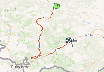

Length
116 km

Max alt
1716 m

Uphill gradient
2860 m
Km-Effort
153 km

Min alt
361 m

Downhill gradient
2631 m
Boucle
No
Creation date :
2020-08-10 09:47:49.894
Updated on :
2020-08-10 09:49:33.49
8h45
Difficulty : Difficult

FREE GPS app for hiking
 SityTrail
IGN / Geographical institutes
SityTrail Plus
The world is yours!
About
Trail Road bike of 116 km to be discovered at Occitania, Aude, Saint-Martin-Lys. This trail is proposed by GuySimonin.
Positioning
Country:
France
Region :
Occitania
Department/Province :
Aude
Municipality :
Saint-Martin-Lys
Location:
Unknown
Start:(Dec)
Start:(UTM)
437609 ; 4740288 (31T) N.
Comments