


PRADS La Faviere. Cabane de Maureen n

RobinMicheline
User GUIDE
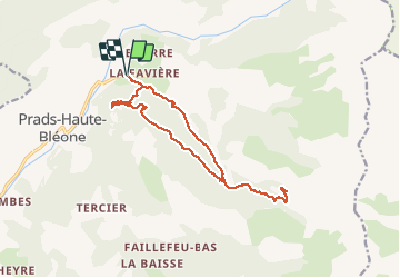

Length
15.6 km

Max alt
1797 m

Uphill gradient
785 m
Km-Effort
26 km

Min alt
1108 m

Downhill gradient
785 m
Boucle
Yes
Creation date :
2020-08-09 04:07:08.364
Updated on :
2020-08-15 16:07:56.289
4h29
Difficulty : Difficult

FREE GPS app for hiking
 SityTrail
IGN / Geographical institutes
SityTrail Plus
The world is yours!
About
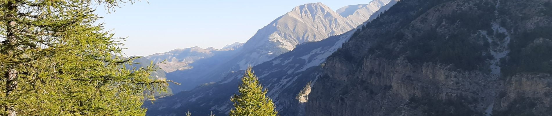
Trail Walking of 15.6 km to be discovered at Provence-Alpes-Côte d'Azur, Alpes-de-Haute-Provence, Prads-Haute-Bléone. This trail is proposed by RobinMicheline.
Photos


Positioning
Country:
France
Region :
Provence-Alpes-Côte d'Azur
Department/Province :
Alpes-de-Haute-Provence
Municipality :
Prads-Haute-Bléone
Location:
Prads
Start:(Dec)
Start:(UTM)
297346 ; 4900665 (32T) N.
Comments