


84 CUCURON Mourre Negre

Nathy8913
User
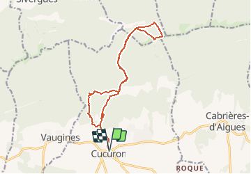

Length
16.1 km

Max alt
1106 m

Uphill gradient
875 m
Km-Effort
28 km

Min alt
349 m

Downhill gradient
875 m
Boucle
Yes
Creation date :
2020-08-13 16:50:19.716
Updated on :
2020-08-13 16:51:51.18
5h38
Difficulty : Medium

FREE GPS app for hiking
 SityTrail
IGN / Geographical institutes
SityTrail Plus
The world is yours!
About
Trail Walking of 16.1 km to be discovered at Provence-Alpes-Côte d'Azur, Vaucluse, Cucuron. This trail is proposed by Nathy8913.
Positioning
Country:
France
Region :
Provence-Alpes-Côte d'Azur
Department/Province :
Vaucluse
Municipality :
Cucuron
Location:
Unknown
Start:(Dec)
Start:(UTM)
696319 ; 4849665 (31T) N.
Comments
attention vers la fin côté st sir au point alti 584 ne pas partir a gauche zone grillagée