


megeve

HG74250
User
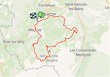

Length
37 km

Max alt
1924 m

Uphill gradient
1624 m
Km-Effort
58 km

Min alt
1095 m

Downhill gradient
1634 m
Boucle
No
Creation date :
2020-08-14 06:15:10.987
Updated on :
2020-08-14 11:02:30.589
4h45
Difficulty : Very difficult

FREE GPS app for hiking
 SityTrail
IGN / Geographical institutes
SityTrail Plus
The world is yours!
About
Trail Mountain bike of 37 km to be discovered at Auvergne-Rhône-Alpes, Upper Savoy, Megève. This trail is proposed by HG74250.
Positioning
Country:
France
Region :
Auvergne-Rhône-Alpes
Department/Province :
Upper Savoy
Municipality :
Megève
Location:
Unknown
Start:(Dec)
Start:(UTM)
315560 ; 5082235 (32T) N.
Comments