


Les Lacs des Millefonts (Variante)

donda
User GUIDE
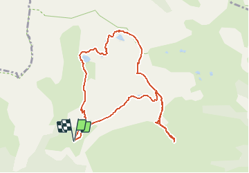

Length
10.1 km

Max alt
2657 m

Uphill gradient
700 m
Km-Effort
19.4 km

Min alt
2031 m

Downhill gradient
703 m
Boucle
Yes
Creation date :
2020-08-16 12:12:04.661
Updated on :
2020-08-16 12:27:59.138
4h05
Difficulty : Difficult

FREE GPS app for hiking
 SityTrail
IGN / Geographical institutes
SityTrail Plus
The world is yours!
About
Trail Walking of 10.1 km to be discovered at Provence-Alpes-Côte d'Azur, Maritime Alps, Valdeblore. This trail is proposed by donda.
Description
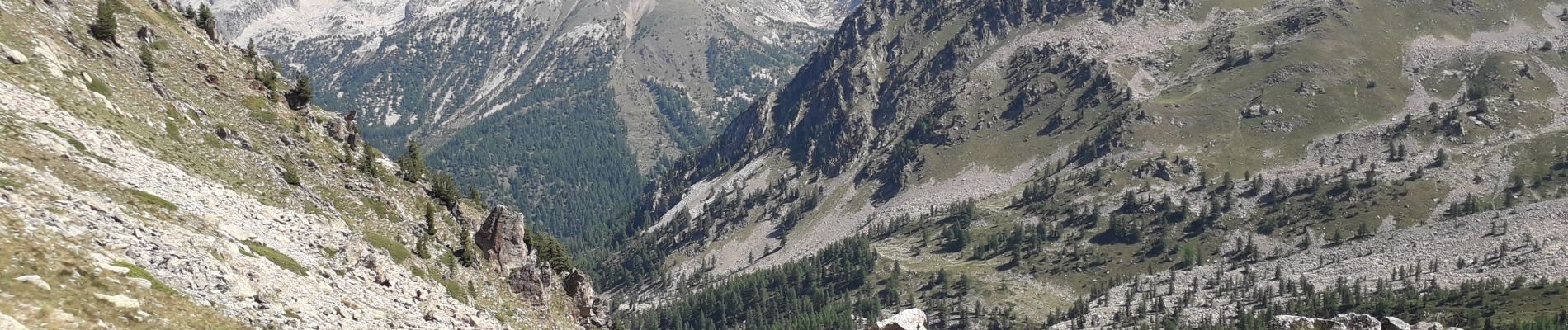
Tour des lacs - Mont Pépoiri - Mont Pétoumier - Tête du Brec - retour par le lac d'En Veillos. (fait le 15.08.2020)
Photos
 - Photo 1")
 - Photo 2")
 - Photo 3")
 - Photo 4")
Positioning
Country:
France
Region :
Provence-Alpes-Côte d'Azur
Department/Province :
Maritime Alps
Municipality :
Valdeblore
Location:
Unknown
Start:(Dec)
Start:(UTM)
354835 ; 4884398 (32T) N.
Comments