


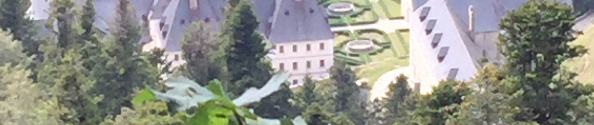
Les chapelles, le monastère des chartreux

choubaka77
User
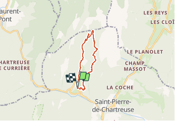

Length
9.6 km

Max alt
1426 m

Uphill gradient
604 m
Km-Effort
17.7 km

Min alt
859 m

Downhill gradient
604 m
Boucle
Yes
Creation date :
2020-08-16 12:24:32.0
Updated on :
2020-08-16 15:21:06.638
2h55
Difficulty : Medium

FREE GPS app for hiking
 SityTrail
IGN / Geographical institutes
SityTrail Plus
The world is yours!
About
Trail Walking of 9.6 km to be discovered at Auvergne-Rhône-Alpes, Isère, Saint-Pierre-de-Chartreuse. This trail is proposed by choubaka77.
Description
Belle boucle mais sans zone de récupération 6 Kms de montée suivi de 6 Kms de descente !!!
Et pas de point d’eau
Photos


Positioning
Country:
France
Region :
Auvergne-Rhône-Alpes
Department/Province :
Isère
Municipality :
Saint-Pierre-de-Chartreuse
Location:
Unknown
Start:(Dec)
Start:(UTM)
718522 ; 5025777 (31T) N.
Comments