


Sous Faudon

ericf64
User

Length
45 km

Max alt
1658 m

Uphill gradient
1286 m
Km-Effort
62 km

Min alt
1122 m

Downhill gradient
1287 m
Boucle
Yes
Creation date :
2020-08-18 08:39:33.301
Updated on :
2020-09-01 16:29:18.958
4h01
Difficulty : Very difficult

FREE GPS app for hiking
 SityTrail
IGN / Geographical institutes
SityTrail Plus
The world is yours!
About
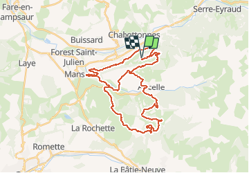
Trail Mountain bike of 45 km to be discovered at Provence-Alpes-Côte d'Azur, Hautes-Alpes, Saint-Léger-les-Mélèzes. This trail is proposed by ericf64.
Description
Mixe des 2 parcours VTT Sous la moraine n°13 rouge et sous Faudon n°27 rouge
Positioning
Country:
France
Region :
Provence-Alpes-Côte d'Azur
Department/Province :
Hautes-Alpes
Municipality :
Saint-Léger-les-Mélèzes
Location:
Unknown
Start:(Dec)
Start:(UTM)
277993 ; 4947275 (32T) N.
Comments