


Laval Cossé

phimar_2612
User

Length
17 km

Max alt
96 m

Uphill gradient
144 m
Km-Effort
19 km

Min alt
59 m

Downhill gradient
144 m
Boucle
Yes
Creation date :
2020-08-18 12:48:42.76
Updated on :
2020-08-18 15:59:30.369
3h02
Difficulty : Easy

FREE GPS app for hiking
 SityTrail
IGN / Geographical institutes
SityTrail Plus
The world is yours!
About
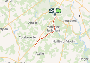
Trail Walking of 17 km to be discovered at Pays de la Loire, Mayenne, Montigné-le-Brillant. This trail is proposed by phimar_2612.
Positioning
Country:
France
Region :
Pays de la Loire
Department/Province :
Mayenne
Municipality :
Montigné-le-Brillant
Location:
Unknown
Start:(Dec)
Start:(UTM)
663321 ; 5322004 (30U) N.
Comments