


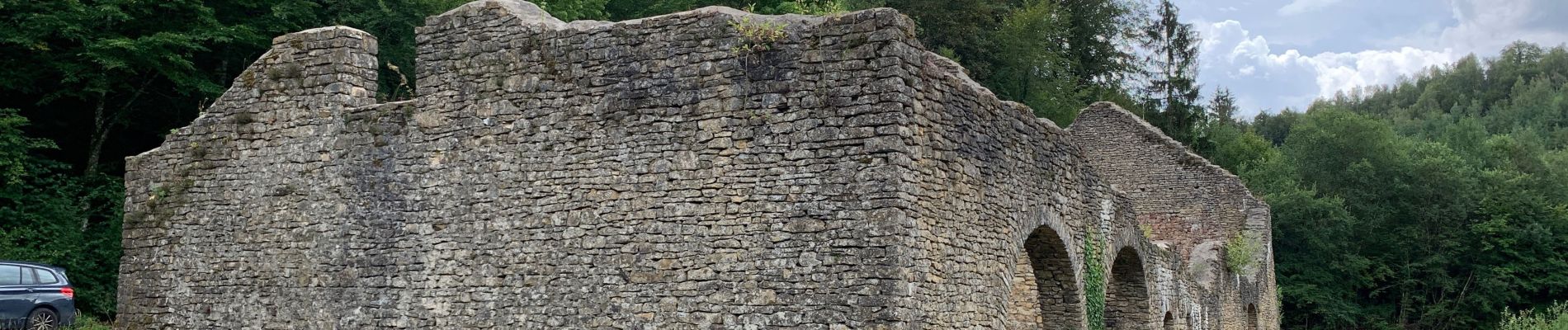
Vallée de Laclaireau et ruines de Montauban

francoisecarlier
User
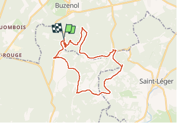

Length
16 km

Max alt
369 m

Uphill gradient
326 m
Km-Effort
20 km

Min alt
244 m

Downhill gradient
313 m
Boucle
Yes
Creation date :
2020-08-18 12:13:52.0
Updated on :
2020-08-21 09:10:59.128
3h47
Difficulty : Easy

FREE GPS app for hiking
 SityTrail
IGN / Geographical institutes
SityTrail Plus
The world is yours!
About
Trail Walking of 16 km to be discovered at Wallonia, Luxembourg, Étalle. This trail is proposed by francoisecarlier.
Photos


Positioning
Country:
Belgium
Region :
Wallonia
Department/Province :
Luxembourg
Municipality :
Étalle
Location:
Buzenol
Start:(Dec)
Start:(UTM)
687187 ; 5500957 (31U) N.
Comments
Attention entre le km 12 et 13 la route n'est plus entretenue. Sinon très belle balade avec un très chouette final !