


plan de l'aar des frasses 2

olivieraron
User
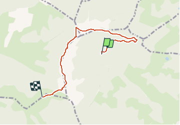

Length
5.7 km

Max alt
1771 m

Uphill gradient
302 m
Km-Effort
9.2 km

Min alt
1558 m

Downhill gradient
133 m
Boucle
No
Creation date :
2020-08-18 16:26:29.314
Updated on :
2020-08-19 06:31:44.276
2h11
Difficulty : Medium

FREE GPS app for hiking
 SityTrail
IGN / Geographical institutes
SityTrail Plus
The world is yours!
About
Trail Walking of 5.7 km to be discovered at Auvergne-Rhône-Alpes, Upper Savoy, Megève. This trail is proposed by olivieraron.
Positioning
Country:
France
Region :
Auvergne-Rhône-Alpes
Department/Province :
Upper Savoy
Municipality :
Megève
Location:
Unknown
Start:(Dec)
Start:(UTM)
312207 ; 5082787 (32T) N.
Comments