


11895062-track-1597826989-18

Renefrt
User
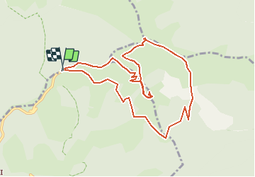

Length
10.7 km

Max alt
2064 m

Uphill gradient
469 m
Km-Effort
16.9 km

Min alt
1765 m

Downhill gradient
472 m
Boucle
Yes
Creation date :
2020-08-19 08:51:12.0
Updated on :
2020-08-19 08:57:41.669
3h29
Difficulty : Medium

FREE GPS app for hiking
 SityTrail
IGN / Geographical institutes
SityTrail Plus
The world is yours!
About
Trail Walking of 10.7 km to be discovered at Provence-Alpes-Côte d'Azur, Maritime Alps, Moulinet. This trail is proposed by Renefrt.
Positioning
Country:
France
Region :
Provence-Alpes-Côte d'Azur
Department/Province :
Maritime Alps
Municipality :
Moulinet
Location:
Unknown
Start:(Dec)
Start:(UTM)
372759 ; 4872590 (32T) N.
Comments