


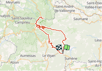
Mont Aigoual par le col de Lusette

mthomas30
User

Length
74 km

Max alt
1562 m

Uphill gradient
1850 m
Km-Effort
99 km

Min alt
187 m

Downhill gradient
1847 m
Boucle
Yes
Creation date :
2020-08-22 07:20:30.054
Updated on :
2020-08-23 19:32:24.025
5h51
Difficulty : Medium

FREE GPS app for hiking
 SityTrail
IGN / Geographical institutes
SityTrail Plus
The world is yours!
About
Trail Road bike of 74 km to be discovered at Occitania, Gard, Saint-André-de-Majencoules. This trail is proposed by mthomas30.
Positioning
Country:
France
Region :
Occitania
Department/Province :
Gard
Municipality :
Saint-André-de-Majencoules
Location:
Unknown
Start:(Dec)
Start:(UTM)
554059 ; 4871901 (31T) N.
Comments