


hall

Mireio
User
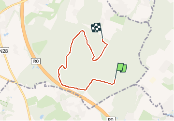

Length
5.2 km

Max alt
140 m

Uphill gradient
59 m
Km-Effort
6 km

Min alt
94 m

Downhill gradient
68 m
Boucle
No
Creation date :
2020-08-22 14:29:23.684
Updated on :
2020-08-22 15:44:12.169
1h14
Difficulty : Very easy

FREE GPS app for hiking
 SityTrail
IGN / Geographical institutes
SityTrail Plus
The world is yours!
About
Trail Walking of 5.2 km to be discovered at Flanders, Flemish Brabant, Halle. This trail is proposed by Mireio.
Positioning
Country:
Belgium
Region :
Flanders
Department/Province :
Flemish Brabant
Municipality :
Halle
Location:
Halle
Start:(Dec)
Start:(UTM)
591771 ; 5617375 (31U) N.
Comments