


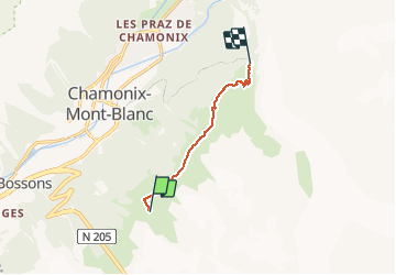
MASSIF DU MONT BLANC: TRAVERSEE PLAN DE L'AIGUILLE - MONTENVERS

djeepee74
User


2h30
Difficulty : Very easy

FREE GPS app for hiking
 SityTrail
IGN / Geographical institutes
SityTrail Plus
The world is yours!
About
Trail Walking of 6.2 km to be discovered at Auvergne-Rhône-Alpes, Upper Savoy, Chamonix-Mont-Blanc. This trail is proposed by djeepee74.
Description
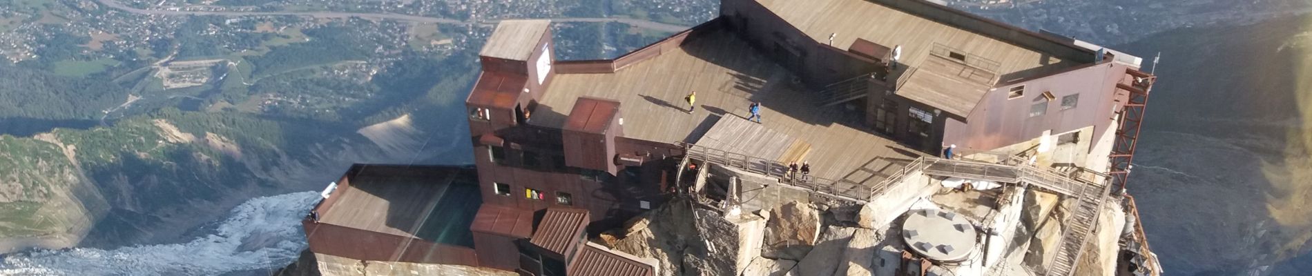
Profitez-en pour monter en téléphérique jusqu'à l'Aiguille du midi... avant de redescendre au Plan de l'Aiguille.
Restauration possible au Montenvers (Mer de Glace... enfin, ce qu'il en reste).
Avec un billet aller/retour de téléphérique Chamonix - Plan de l'Aiguille, vous pouvez prendre le petit train du Montenvers pour rejoindre la vallée, et vice versa... à moins de descendre à pied par un des sentiers... voir le tracé via la "buvette des Mottets".
Les photos du tracé datent du 24 août 2020... les autres du 20 juillet 2019.
Photos


27 photos in total. Please click on a photo to see them all in the gallery.
Positioning
Comments