


Vercors_villard de Lans_Lac Moucherolle_Col deux soeurs_combe de l'ourson

m261212
User
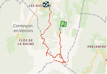

Length
15.1 km

Max alt
2262 m

Uphill gradient
702 m
Km-Effort
26 km

Min alt
1148 m

Downhill gradient
1275 m
Boucle
No
Creation date :
2020-08-25 06:58:26.07
Updated on :
2020-08-25 07:22:00.793
5h26
Difficulty : Very difficult

FREE GPS app for hiking
 SityTrail
IGN / Geographical institutes
SityTrail Plus
The world is yours!
About
Trail Walking of 15.1 km to be discovered at Auvergne-Rhône-Alpes, Isère, Villard-de-Lans. This trail is proposed by m261212.
Positioning
Country:
France
Region :
Auvergne-Rhône-Alpes
Department/Province :
Isère
Municipality :
Villard-de-Lans
Location:
Unknown
Start:(Dec)
Start:(UTM)
702412 ; 4989456 (31T) N.
Comments