


z la Bouverie 25-08-20

cb8310
User
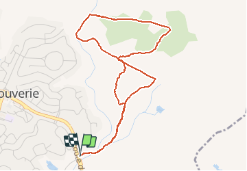

Length
5.5 km

Max alt
83 m

Uphill gradient
73 m
Km-Effort
6.4 km

Min alt
32 m

Downhill gradient
73 m
Boucle
Yes
Creation date :
2020-08-25 06:26:03.934
Updated on :
2020-08-27 06:01:15.176
1h48
Difficulty : Very easy

FREE GPS app for hiking
 SityTrail
IGN / Geographical institutes
SityTrail Plus
The world is yours!
About
Trail Walking of 5.5 km to be discovered at Provence-Alpes-Côte d'Azur, Var, Roquebrune-sur-Argens. This trail is proposed by cb8310.
Description
rando sans difficultés alliant larges pistes et chemins caillouteux
Photos

Positioning
Country:
France
Region :
Provence-Alpes-Côte d'Azur
Department/Province :
Var
Municipality :
Roquebrune-sur-Argens
Location:
Unknown
Start:(Dec)
Start:(UTM)
310288 ; 4818478 (32T) N.
Comments